A 38-unit group dwelling proposed for East Caret Bay has raised concerns for residents who’ve said they understand the need for more affordable housing in the territory, but suggested the development be cut down to mitigate environmental, and other, impacts to the neighborhood.
Hundreds of comments and questions had been submitted by the time a public hearing was convened by Planning and Natural Resources last week, with residents asking for more clarity on everything from parking spaces, disposal of waste, construction time and traffic flow across the one road in and out of the neighborhood. The public still has until Sept. 15 to offer comments, according to DPNR staff.
Though group dwelling permits are rare – DPNR said only 13 such projects have been permitted in the past 18 years – they are allowed under a range of zonings, including R-1 and R-2, with the density for R-2 calculated at two units per every 10,000 square feet or eight units per acre, whichever is greater.

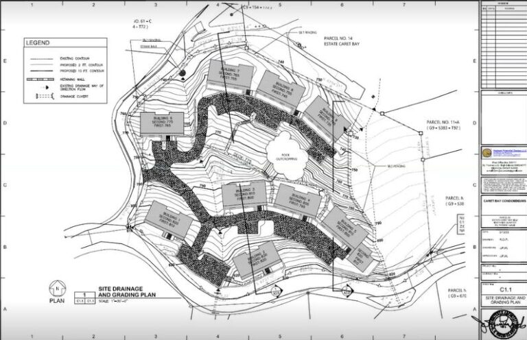
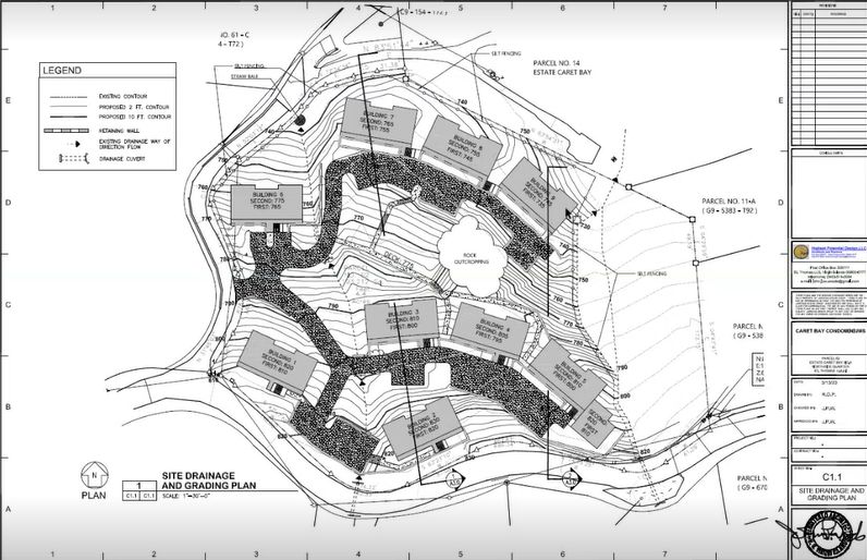
The project sits on a 4.41 acre site at the top of the East Caret Bay entrance, and according to applicant John Woods – an architect and principal with Highest Potential Design – houses the 38-units within nine buildings, with each unit split into a top and bottom floor, each with two bedrooms and two bathrooms, a living room and other amenities. According to the V.I. building code, about three occupants can live within each unit, putting the total maximum population of the development at about 114 people.
A total of 42 parking spaces will be built for the 38 units.
Woods said the group dwelling was picked not only to maximize the use of the property but to be able to preserve as much of the parcel’s natural environment as possible, as opposed to a subdivision, which could stretch from end-to-end. The units will not be sold as condos, and by law, cannot be used as short-term rentals, he said.
“The owner was trying to address the growing need within the territory for reasonably priced apartments as much of the development in this territory tends to be luxury or low-income,” Woods added. “This target market is neither, but certainly more of a middle range.”
The Details
In his presentation Friday, Woods said there are two guts on the eastern side of the property, a large rock outcropping within that can’t be disturbed and a culvert on the northern side where a bin site is located on the main road.
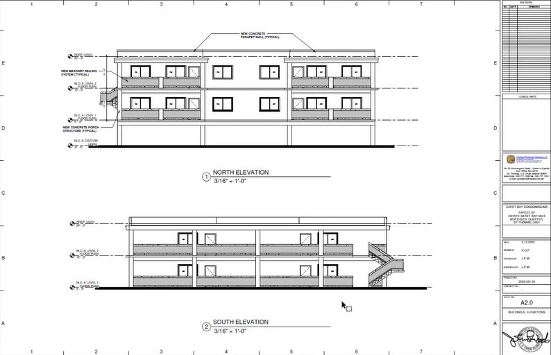
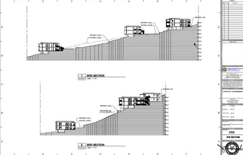
Each building structure has about a 3,000 square-foot footprint, two floors each, with a building on the right that has one additional unit for three per floor. The space between floors is approximately 10 feet so that cisterns embedded into the property don’t exceed nine feet in elevation. Retaining walls are limited in height, and silt fencing will surround the site to limit the debris and runoff as construction is ongoing, Woods said.

Meanwhile, the entire eastern side and gut will remain undisturbed, as Woods explained that the development team intended to maintain the natural landscaping of the property, guided by a flora and fauna study that found a growth of native orchids and fruit trees planted on the site, as it was used previously as a farm.
“About 53 percent of the area is not going to have any type of construction, whether its building space or driveways,” Woods said. “Of that, 40 percent is undisturbed vegetation, with the requirement from DPNR being 30 percent.”
In terms of a drainage control plan, meanwhile, Woods said the eastern gut will remain untouched, but the western one, which will be “touched” by two driveways and a piece of one of the buildings, will be supported by culverts due to the “volume of water anticipated in that area.” As many buildings as possible will be grouped together for package treatment plants for disposal of sewage, with the smaller ones – a string of three buildings – accommodating 1,500-2,000 gallons per day, and the larger ones 4,500-6,000 gallons per day.
Package treatment plants don’t operate like septic systems, Woods said, adding that the waste is cleaner and will be filtered through the system so that it could be used for irrigating the landscaped areas.
Otherwise, wastewater disposal and electrical service coming in will go underground, water supply is through cisterns like most buildings in the area, and solid waste pickup will be done building by building – a service built into the cost of rent – and disposed by an independent carrier. It’s likely that solar electrical systems will be put on the concrete roofs to offset the cost of electricity, Woods said.
If permits are approved, the plan for construction is to go building by building in a single phase, east to west, with each building taking about nine months to complete.
Community Concerns
During a more than hour-long discussion after the presentation, concerns abounded from residents and even DPNR staff, who questioned whether any objections were received from the State Historic Preservation Office since a cultural resources study conducted by the project team turned up a small group of artifacts that Woods said were found close to the main road and could have been a result of other construction.
Responding to additional concerns from DPNR staff about privacy for the neighbors, Woods said there will be a level of “buffering,” especially to the east where the road will be 100 feet away from the nearest buildings. On the other sides, the structures are below Lionel Berry Road – the main highway running west from Four Corners to Crown Mountain – so no one will be able to see them, he added.
“Coming down the East Caret Bay road, except for where the entrance is, there’s one of the buildings close to the road, but the others are fairly far in – the landscaping will hide most of them, but even with the closest building, we intend to buffer to the greatest extent,” Woods said.

Other questions focused on damage caused to the Caret Bay roads by construction trucks, the impact to the bin sites on the upper road, what happens if the project stops and the financial viability of the new property owner and project manager.
“As adjacent property owners, we would appreciate if DPNR would explain the capacity and capability of the owner/developer to deliver a sound project which can or may add value to the neighborhood, yet not take away or negatively disrupt the tranquility of the existing neighborhood,” one homeowner wrote in a letter that was read into the record during the meeting.
Others sought clarity on plans to handle the additional solid waste that would be generated by residents of the development.
“The current resident density averages one family per .75 acres,” residents shared in the meeting chat. “The new development will have a density of one family per .116 acres. This is significant in density, nearly doubling the population of the neighborhood, and will add the waste of 100-plus people and pets into the existing overtaxed system. The triple dumpsters perched up on the main road are already an eyesore and are frequently too full for us to be able to dispose of our waste.”
Of significant concern was the lack of parking spaces within the development and how the potential spill-over would impact traffic flow for the families living in the neighborhood. A house currently constructed on Lionel Berry Road without off-street parking has resulted in traffic back-ups on a blind curve that makes going around dangerous and cumbersome, residents said.
“Our community has many walkers, runners, dog walkers and bikers that traverse these roads daily. The existing traffic volume combined with a lack of sidewalks already proposes a major hazard. An additional 75-plus cars coming and going at least twice daily could end in a fatality,” residents wrote, asking what precautions are being put in place to keep the neighborhood safe.
Many also questioned the timeline for the project, citing the potential for years of construction as each building is expected to take nine months to construct, erosion and drainage issues – particularly for a neighborhood that is harder hit during stronger storms – and the strain on the existing infrastructure.
Generally, residents said they were not opposed to the idea of the project, but asked that it be done on a smaller scale and with improvements to the plans that address the safety and environmental concerns. DPNR staff said that all comments and questions will be taken to the applicant and development for review and revisions before permits are considered.